New Publication in NEJM AI

How can generative AI advance Target Trial Emulation?
In a new editorial published in NEJM AI, authors Issa Dahabreh (CAUSALab, Harvard T.H. Chan School of Public Health), Robert Yeh (Beth Israel Deaconess Medical Center, Harvard Medical School), and Piersilvio De Bartolomeis (ETH Zürich) explore how AI computational tools can transform causal analyses.
“Trial Emulation, Simulation, and Augmentation Using Electronic Health Records and Generative AI”
Researchers reference TRIALSCOPE, a computational tool for processing electronic health record data, to demonstrate how AI can support target trial emulation, enhance observational data extraction and analysis, and improve the efficiency of clinical trials.
“The major takeaway for me is that we can use AI tools to significantly accelerate target trial emulation and the way clinical trials are designed and analyzed” said Piersilvio De Bartolomeis.
Read the editorial now in NEJM AI.
Last Updated


Delta Scholar Trinity Wilson’s article is published in Public Service Review: Winter 2024

Trinity Wilson, an Undergraduate Delta Scholar (2024 – 2025) from Alcorn State University, wrote an article in the Stennis Center for Public Service Review: Winter 2024, on the 17th Amendment and honors the election of Hiram R. Revels as the first Black U.S. Senator, reminding us of the historical weight and continuing relevance of representation in public life. Great work, Trinity!
https://stennis.gov/public-service-review-winter-2024
Last Updated
Helping Hands: The Mississippi Delta Food Community Documentary Screening
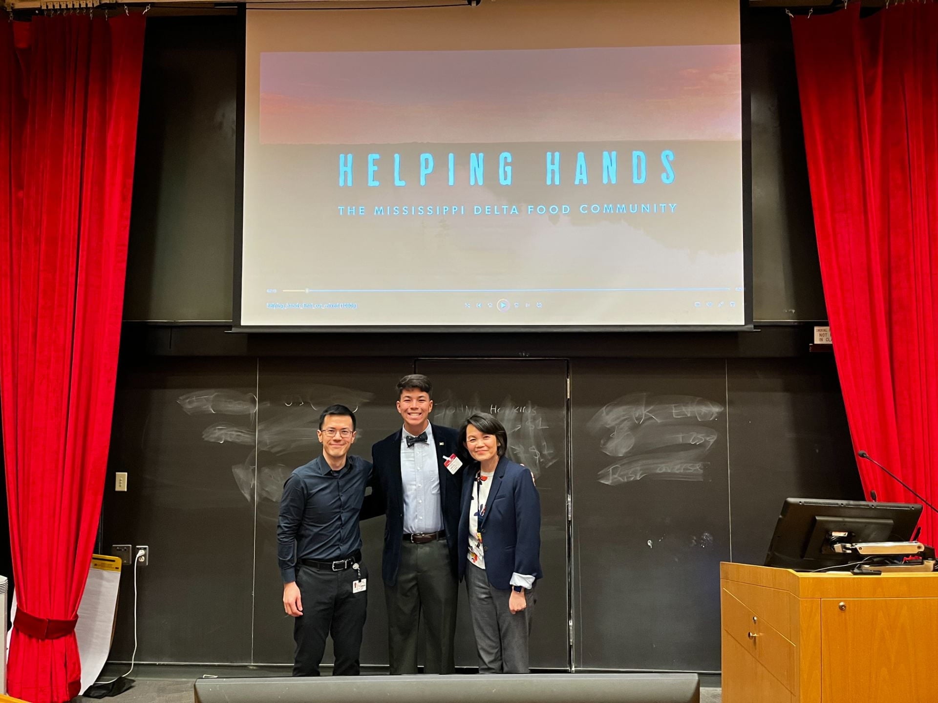
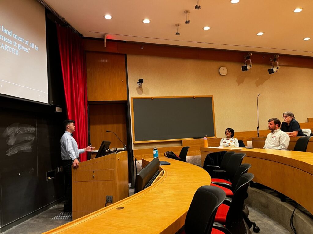
On April 14, 2025, Jack Thomas Spears, an Undergraduate Public Health Delta Scholar from the 2023-2024 cohort and a graduating senior from Mississippi College, presented his documentary, “Helping Hands: The Mississippi Delta Food Community” at the Harvard T.H. Chan School of Public Health. The documentary was inspired by his capstone project for the Delta Scholar Program in 2023 and his honors thesis. “Helping Hands” explores food deserts in the Delta, but instead of focusing on the problem, Jack chose to spotlight and lift the voices of the incredible people and organizations working to combat food insecurity in the Delta. Jack’s thoughtful approach to the issue and the high quality of the documentary left a profound impression on the audience.
Last Updated
Boston Conference (November 12-14, 2024)
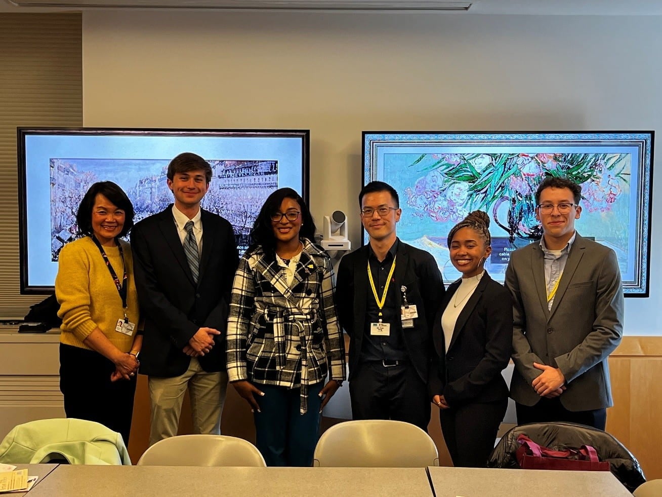
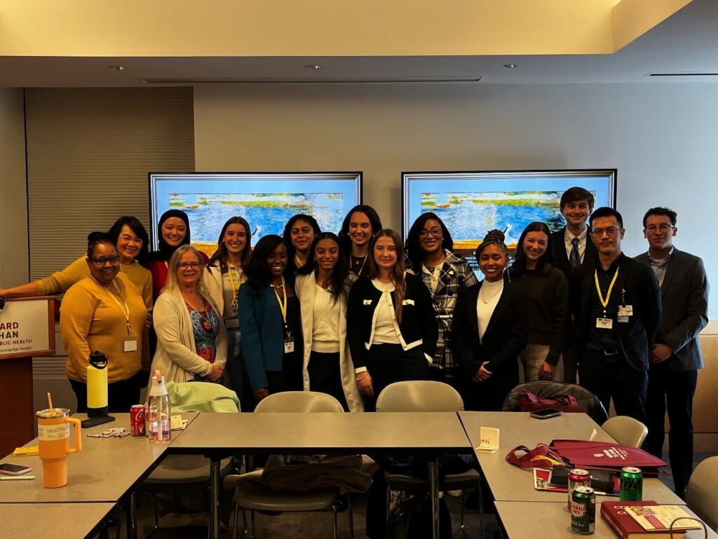
Delta scholars and four faculty members from the Mississippi State University visited Boston from November 12-14, 2024 for the Boston Conference. The Delta Scholars program partner institutions, Harvard Law School and Brandeis University, hosted the scholars and faculty members on the first two days. The Harvard T. H. Chan School of Public Health welcomed the group to our school on November 14. Senior Associate Dean, Nancy Turnbull, welcomed the 2024 cohort with her opening remarks. Five Delta Scholars presented their Delta Projects here at the Harvard T. H. Chan School of Public Health:
- Bre’Anna Coleman, University of Mississippi, The Intersectionof Faith and Mental Healin
- Bowen Mansell, Mississippi State University, A Pre-HealthAmbassadors Mentoring Committee
- Dominic Chavez, Mississippi State University, Changing the Conversation: A School-Based Approach to Expanding Mental Health Literacy
- Andrea Rivera, Rutgers University, Addressing Medical Mistrust Within the POC Community: Black Maternal Health
- Trinity Wilson, Alcorn State University, The Land Don’t Know Color
The scholars also had the opportunity to listen to Harvard Chan’s students about their journey and motivation to pursue public health. The panels consisted of Meghana Sai Iragavarapu (MPH Nutrition), Brynn Macaulay (MPH Global Health and Population), Rediet Bayou (MPH Health Policy), Marissa Chan (PhD Environmental health), and Alex Mellott (SM Biostats). The panel was moderated by Artair Rogers (PhD candidate Social and Behavioral Science). The lived experiences and the passion of the Harvard Chan students resonated with the scholars and inspired many to consider public health as a career.
In the afternoon, we were joined by Francisco Alvarez, a Harvard Chan School alum (MPH-Health Management) and former Rose Fellow who shared about the power of art in healing and his new start-up Asiri Health Arts.
After an exciting and engaging day, Bill Gardner, Assistant Director of Admissions, gave valuable insights for application to the programs at the Harvard T. H. Chan School of Public Health.
Last Updated
New Jobs and Internships in Maternal, Newborn and Child Health
| Job | Organization | Location |
| Programme Analyst on Sexual and Reproductive Health | UNFPA | Tunisia |
| National Post – Programme Assistant, Gender & Youth | UNFPA | Zambia |
| National Post – Programme Assistant, SRHR | UNFPA | Zambia |
| Sexual and Reproductive Health Analyst | UNFPA | Angola |
| Programme Specialist, SRH | UNFPA | Tanzania |
| Humanitarian Evaluation Advisor | UNFPA | Nairobi |
| Program Officer, HIUD Access | CHAI | Cameroon |
| Director, Women’s & Newborn Health | CHAI | Malawi |
| Program Officer, MCH Nutrition Health | Gates Foundation | Nigeria |
| Health Manager non-Sierra Leonean nationals | UNICEF | Sierra Leone |
| Job | Organization | Location |
| National IC Post: Regional Access Officer | UNFPA | Afghanistan |
| Programme Associate, Vientiane Capital | UNFPA | Laos |
| Programme Specialist, Humanitarian Coordination and GBV | UNFPA | Myanmar |
| Program Officer (HAPPI) | CHAI | Pakistan |
| Monitoring, Evaluation, Research and Learning Officer | CHAI | Pakistan |
| Community Engagement Coordinator (HAPPI) | CHAI | Pakistan |
| Provincial Coordinator (TCA) | CHAI | Pakistan |
| Project Manager (TCA) | CHAI | Pakistan |
| National Consultant – Legislative Review on Children’s Rights | UNICEF | Maldives |
| Job | Organization | Location |
| Innovation Specialist, Strategic Coordination | UNFPA | New York, USA |
| Intern, Leave No One Behind, Gender, Human Rights | UNFPA | New York, USA |
| Evidence and Learning Manager, Global SRH | CHAI | USA |
| Spec, Health Nutrition | Save the Children | North Carolina, USA |
| Senior Strategy Officer, Global Policy & Advocacy Office | Gates Foundation | Seattle, USA |
| Deputy Director, Nutrition R&D | Gates Foundation | Seattle, USA |
| Job | Organization | Location |
| National Post: Programme Assistant | UNFPA | Brazil |
| Programme Analyst, Sexual & Reproductive Health (SRH) | UNFPA | Nicaragua |
| Job | Organization | Location |
| National Health Consultant, Bulgaria nationals only | UNICEF | Bulgaria |
| Job | Organization | Location |
| Consultant – research on the misuse of technology to facilitate child marriage | UNFPA | Remote |
Last Updated
New Jobs and Internships in Maternal, Newborn and Child Health
| Job | Organization | Location |
| Director, Women’s & Newborn Health | CHAI | Malawi |
| National Positions: Sexual and Reproductive Health Programme Specialist, NOC | UNFPA | Nigeria |
| Deputy Representative, Ouagadougou, Burkina Faso | UNFPA | Burkina Faso |
| UNFPA Representative, Burkina Faso | UNFPA | Burkina Faso |
| Health & Nutrition Specialist, (NO-3) | UNICEF | Mozambique |
| Reproductive, Maternal & Neonatal Health Officer | WHO | Central African Republic |
| Policy Manager – Health | J-PAL | Rwanda |
| Job | Organization | Location |
| Program Officer – Mumbai | Jhpiego | India |
| Communications and Design Associate – Delhi | Jhpiego | India |
| Chief of Party (COP), USDA-funded McGovern-Dole Food for Education and Child Nutrition Program | Save the Children | Pakistan |
| Maternal & Child Health Specialist, P-3, Pacific Multi Country Office | UNICEF | Solomon Islands |
| Health & Nutrition Officer, NO-2 | UNICEF | Kazakhstan |
| Project Director, Indonesia Maverick Collective MCH Project | PSI | Indonesia |
| MCH (Maternal Child Health) Consultant | PSI | Indonesia |
Last Updated
Dr. Anete Muxlhanga’s Mission: Local, Data-Driven Solutions for Maternal Health in Mozambique
Mozambique faces significant maternal health challenges, compounded by ongoing conflict and a recent surge in political instability. The maternal mortality rate remains high at 127 deaths per 100,000 live births, far above global averages. Women of reproductive age (15–49) are also disproportionately affected by the HIV epidemic, with a high prevalence of 15.4%. The interconnected challenges of maternal health, HIV, and healthcare inequities call for a paradigm shift in global health research—one that prioritizes regions like Mozambique and passes the torch to local actors.
By: Audrey Benson, a researcher and writer with experience in quantitative and participatory projects at the intersection of health, gender, and migration. With a Master’s in International Health from the University of Barcelona, she is passionate about addressing global sexual and reproductive health inequities and believes in the power of research and storytelling to drive meaningful change.
Maternal and Child Health in Mozambique: A Physician’s Perspective
Dr. Anete Muxlhanga, a Mozambican physician and researcher, provides firsthand insights into these challenges. Hailing from Maputo, she began her medical career during the COVID-19 pandemic, working in some of Mozambique’s largest treatment centers. Her exposure to maternal health issues came as she treated pregnant and postpartum women during the pandemic.
Through her observations, Dr. Muxlhanga noticed how the pregnant women she treated faced increased risks of complications and death. These risks were not just due to lack of robust healthcare systems or the disease itself, but also gaps in medical research and data collection. Pregnant women have historically been excluded from clinical trials, leaving them with limited treatment options. Adding to this issue, Mozambique often lacks basic data on maternal health risks, hampering efforts to address specific needs of these women effectively.
The Role of Local Research in Driving Systemic Change
Dr. Muxlhanga’s current role at the Manica Health Center has given her a deeper understanding of how rural and urban disparities exacerbate healthcare inequalities. In rural areas, the challenges of connecting mothers to maternal and child healthcare are amplified. These disparities drive her commitment to systemic reforms that go beyond addressing immediate symptoms.
Her contributions to initiatives like MAMAH (Improving Maternal and Infant Health by Reducing Malaria Risks in African Women) have been vital in uncovering critical gaps in maternal healthcare. For example, the lack of comprehensive patient data in Mozambique prevents policymakers and healthcare providers from identifying risk patterns or allocating resources to the extent they aim to. Addressing these gaps will require systemic support to empower local healthcare providers and researchers to develop tailored, data-driven solutions.
Shifting the Gravity of Global Health Research Towards Local Leadership
Global health research has traditionally been dominated by Western paradigms, with solutions designed in high-income contexts that often fail to address the realities of low-resource settings. Sub-Saharan Africa accounts for 70% of global maternal deaths, yet only 1.3% of global health publications are produced by professionals and institutions based on the continent. This disconnect perpetuates misaligned research priorities leading to insufficient progress in addressing health disparities.
Institutions like the University of Edinburgh have called for a shift in the “gravity” of global health research toward the Global South, where the burden of disease is greatest. This deconstructive approach requires lifting up local actors, building research capacity, and decentralizing funding to ensure resources align with the priorities of affected communities.
Investments in maternal health have already shown impact—for example, the $4 billion globally spent on family planning annually saves $5.6 billion in maternal and newborn health services. However, funding alone is not enough; it must be coupled with localized, context-sensitive approaches.
Solutions from the Ground Up: Research in Education and Data Sovereignty
Dr. Muxlhanga herself believes in the power of research. She suggests that education of medical providers should include at least some exposure to research or basic tools empowering workers to investigate patterns they identify on the ground. “Healthcare providers with a general understanding of medical research and the role data plays will more likely thoroughly and accurately report patient records,” she says, addressing the lack of robust health data.
While acknowledging the healthcare system’s resource constraints, she emphasizes the importance of local action over reliance on external aid. “If external actors aren’t going to fund issues that matter to the people,” she says, “it’s important to collect the data now and not wait until someone else decides it is important.” By building a culture of research and data sovereignty, the country can break free from reliance on external actors and create health policies driven by local realities.
Sovereignty and Creative Solutions: A New Dawn for Mozambique
Despite the challenges, Dr. Muxlhanga remains optimistic about the future of maternal and child health in Mozambique. She believes progress is achievable through “good work with love and patience” and creative solutions led by local actors. Inspired by the resilience and warmth of Mozambique’s people, she likens her hope for the country’s future to its sunsets, which she calls “the most beautiful in the world.”
Despite studying and working in various contexts, her belief in Mozambique’s unmatched potential endures. By prioritizing local leadership, fostering research sovereignty, and developing context-specific solutions, Mozambique—and the global health community—can work toward a future where no woman dies from preventable causes during childbirth.
Last Updated
New Jobs and Internships in Maternal, Newborn and Child Health
| Job | Organization | Location (Country) |
| Program Officer – Digital Health | PATH | India |
| Intern, Family Health | PATH | India |
| Research Policy Manager – Every Child Counts – J-PAL South Asia | J-PAL | India |
| MCH (Maternal Child Health) Consultant – Indonesia | PSI | Indonesia |
| Chief of Party, Cambodia SOPHI Project | PSI | Cambodia |
| Project Director, Cambodia One Health Project | PSI | Cambodia |
| International Post: Project Manager Consultant IIC- Kabul, Afghanistan | UNFPA | Afghanistan |
| Monitoring and Evaluation Officer | Jhpiego | Israel |
| Senior Research and Learning Officer-MNCH and Cancer Care | Jhpiego | India |
| Individual international consultancy in Capacity Building, Supervision, and Community Engagement in IMCI and Pocketbook Implementation. | UNICEF | Turkmenistan |
| Job | Organization | Location (Country) |
| Programme Assistant, GS5, Guatemala City, Guatemala, 123106, [Temp Appointment 364 days] | UNICEF | Guatemala |
| Job | Organization | Location (Country) |
| Technical Lead, Child Development | WHO | Switzerland |
| Health & Nutrition Officer, Temporary Appointment (364 days), NO-2, Odesa, #130027 – open for Ukraine Nationals Only | UNICEF | Ukraine |
Last Updated
Where Did My Midwife Go?
Ariel Bernstein, MPH, CPM is a midwife in the US having practiced in 4 different states before she received her Masters in Public Health in global health from Harvard University. She is passio1nate about expanding the role of midwives worldwide and firmly believes that midwives should be at the center of all maternal health systems and that they have the power (given the right tools) to end excess maternal mortality globally.
Underpaid, under-appreciated, understaffed, and burnt out. Midwives are walking away at time when the world needs them most.
According to leading global health institutions, worldwide there is an estimated shortage of nearly 1,000,000 midwives. While many organizations are working to figure out how to increase that number, and train more midwives, increasingly in the west midwives are leaving the profession.i In a recent posting on a Facebook group for midwives that has thousands of members, somebody proposed the question, “In your opinion, why do you think midwives and other birth care workers are walking away from midwifery.” There were over 300 answers within 24 hours and the number one cited reason in the comments was burnout. Midwives discussed repeatedly that they simply couldn’t make it work year after year. Low wages, the endless stress of being on call, lack of childcare support for a heavily female dominated profession, moral injury, political instability and the impact of laws on female reproductive healthcare, were the most common issues raised as the reason for midwifery burnout. Midwives reported that being a midwife “destroyed their health” and many talked about how it even affected their personal relationships, with many comments citing high divorce rates and the impact of their career on trying to raise a family. In a profession that is mostly female, the issue of work-life balance when it comes to raising a family has a lasting impact on workforce retention and career longevity. How can women be expected to support the childbearing cycle of others if their profession doesn’t support their own family planning goals?
Many midwives also talked about the crushing level of responsibility that they carried, and how the weight of the liability of their job can be crushing (morally, emotionally, and psychologically). Midwives reported not being able to take adequate time off to rest or recover, particularly after difficult outcomes, especially for certified professional midwives and those in private practice. Many people talked about secondary trauma, from witnessing difficult births or going through traumatic experiences with their patients. They discussed not being able to recover from such events or getting enough support to process things that they witnessed including obstetric violence. Many midwives talked about how they work in a broken system, or rather, a system is not broken but is not designed to support better outcomes for providers or patients.
Midwives expressed that they had gone through years of training that often left them starting their career as a provider already burnt out with little support due to a training process that many also feel is inherently abusive. Another consistent comment reflected low salaries; highlighting how midwives view their pay in relation to the amount of time spent on call, the intensity of the work, and the level of responsibility that they shoulder. Many midwives reported that they simply were not able to make a living despite working long hours. The cost of care delivery is especially burdensome for those who are in private practice and those caring for vulnerable populations. This was especially true for midwives who worked in a community setting and have erratic call schedules that might leave them being on call 24/7 for weeks if not months on end.
The mental health aspect of burnout cannot be ignored. While birth is often the most transformative and joyous event in someone’s life, it can also be traumatizing for providers who witness, experience, and hold space for families who experience miscarriages, stillbirths, and infant loss as well as other negative outcomes. For some midwives, the mental toll of never having time off, or never knowing when they might be called to work, and never truly being able to relax or shut their phones off exacerbate their own mental health. Someone described it as “Swimming upstream your whole life, fighting the current.”
Additionally, “moral injury” – the trauma of being required to do things within the context of a medical system that they felt was against their own moral values, was cited as an overlooked mental health factor. Adequate rest, time off, and compensation for a physically, emotionally, and psychological taxing profession must be addressed.
Comments shared repeatedly how difficult it is to work in both the community setting and the hospital setting with little respect from the medical system. One midwife stated, “Midwifery is emotionally physically and intellectually exhausting, it asks us to sacrifice everything for others.” Midwifery requires a deep level of empathy, and therefore attracts people to the profession who are deeply empathetic, it is the role of the midwife to care deeply for others, but it often means that there is no one left to care deeply for her. It is impossible to give of yourself for years without having a work-life balance, or enough time and resources to take care of oneself. One of the most common words repeated was “sacrifice”. Midwives felt that by and large midwifery was a career of sacrifice. Sacrificing oneself, one’s time, even one’s family to take care of others. It is impossible to continue to sacrifice yourself forever.
The health impact of midwifery is also significant. One midwife shared, “Our body breaks down due to physical mental and emotional abuse, lack of self-care and boundaries.” There were also comments about how expectations from patients have changed over time, with many midwives feeling that patients increasingly have unrealistic expectations about the role of their provider in their birth outcome. Community based midwives talked about how when the need to transfer occurs there is a fear increasingly of the blame being placed on them instead of an acceptance of a change of plans being necessary to provide safe care. A fear of prosecution and litigation was also mentioned dozens of times with difficult to navigate political issues affecting reproductive health especially in the US.
If the world needs more midwives, then we must take care of our workforce! We cannot, as a global community, continue to demand that midwives provide so much with so little resources and support. No matter where midwives practice the themes remain the same: they just do not have enough support to keep going. Midwives deserve to be compensated; they deserve to be paid well for their highly skilled profession. They deserve respect and autonomy in practice. Especially in the US, they deserve to be integrated into the larger medical system and respected for filling a critical role in providing excellent maternity care in a country that is increasingly failing to serve with the needs of mothers. A critical look at how to retain existing midwives in the workforce globally is necessary. We cannot simply create a system that trains people just to chew them up and spit them out.
Last Updated
Meeting the target but missing the point: The politics of childbirth data

Pressure to meet targets to improve health outcomes for women and their babies can have unintended negative consequences.
Rose, one of two nurse-midwives on duty in a hospital labour ward in Southern Tanzania, slumps down into a chair and lets out a sigh. The desk she sits at is covered with loose sheets of paper and register books. This is the documentation she is expected to complete about the birthing women under her care. Some of the documents are meant to guide decision-making about the care women receive – plotting a woman’s contractions on a chart called the partograph, for example, helps track progress of labour. But Rose fills out most of the documentation after a woman has already given birth, “once the mother and her baby have crossed safely”, as she describes it. Understandably, this paperwork is not her favourite part of the job. It is time-consuming and she considers it a tedious task. When the workload is high, it can be near-impossible to complete all the reporting requirements. Working in a labour ward is predictably unpredictable – some shifts pass without a single new patient arriving, while other days Rose finds herself managing five women in active labour at once. When someone needs urgent care, documentation is the least of her priorities, she says: “When an emergency comes, you leave those things because you can’t deal with paperwork when there is a patient who needs help.” However, her managers will not accept incomplete documentation. Data collected by care providers are reported to the district health office, before being sent to regional and national levels. The health of women and newborns is high on the political agenda in Tanzania, and data about their survival are closely monitored. Top-level Tanzanian government officials and health managers recently expressed a renewed commitment to ensure “zero maternal deaths.” As a result, Rose points out, data about mothers and their babies have become “political stuff”. This is by no means unique to Tanzania. In the last few decades, the field of global health has rallied around achieving targets like the Sustainable Development Goals (SDGs). Particularly in donor-dependent countries, this drove an increase in what has been called “target culture”. Linking to commercial notions of cost-effectiveness, policymakers and donors want to know how many lives are being saved by specific policies and interventions, and at what cost. Tracking progress towards global goals has increasingly become a priority, and this requires data. Targets come from good intentions and can have real benefits. Agreeing on a common goal can create momentum and can help hold leaders accountable for advances towards safer childbirth. Yet, some targets are unrealistic in contexts where women’s health is shaped by poverty and social disadvantage, and where health facilities face shortages of staff, supplies and essential medicines. Improving maternal and newborn health is complex – no single ‘silver bullet’ will fix it all. And, as is clear from the experiences of Rose and her colleagues, target culture may also create an environment where health care workers are afraid to be blamed if they report on negative outcomes. So afraid, in fact, that they might not always report exactly what happened. A recent review of studies conducted in low- and lower-middle income countries found that manipulation of maternal and neonatal health data among health care workers was not uncommon. In order to meet specific targets or protect themselves from blame, health care workers might alter or fabricate some of the data they are expected to report. Although this was a sensitive topic among Rose and her colleagues, they described various examples of what they referred to as ‘cooking’ data. During shifts where it is not possible to check the heartrates of unborn babies as often as required for all women on the ward, one nurse-midwife explained, danger signs might be missed. But to avoid being blamed for any problems that might arise, the nurse-midwife can make it look like she listened to the foetal heartrate more frequently: “You come to listen to the mother, oh no! She was in distress [the baby was not well] since long ago. So you come here, you write data that doesn’t exist, now you are cooking up partographs.” To prevent being scrutinised as a result of incomplete data, or to protect themselves from blame after a poor outcome, health care workers can thus fabricate or alter the data. “Target culture” can have unintended consequences on data quality. When expectations are not realistic and health care workers fear being blamed or losing their job, they can feel ‘cooking’ data is the only option available to them, resulting in data that do not reflect what truly transpired. We must consider how the workload of routine data collection can be made feasible and relevant to the health care workers doing it, so that the usefulness of the data to help improve quality of patient care is clear to them. Otherwise, we might end up meeting the target, but missing the point. —
Quotes and observations were drawn from qualitative research in Southern Tanzania conducted by PhD candidate Jil Molenaar in 2023. To protect confidentiality, names have been changed and places are not specified.
—
Quotes and observations were drawn from qualitative research in Southern Tanzania conducted by PhD candidate Jil Molenaar in 2023. To protect confidentiality, names have been changed and places are not specified.